

Satellite Imagery Analysis to Identify Availability of and Assess Agricultural Potential
GEO Decisions is implementing a monitoring system, based on satellite imagery analysis, in order to provide decision makers and stakeholders tools to better synergise actions in the preservation and development of natural resources.
An initiative of GEO Decisions
Overview of the project
This project is part of the promotion of sustainable development and the preservation of natural resources in Maritime Guinea, a region strongly affected by anthropisation and prey to climate change. The joint actions of local authorities and the government are, nevertheless, still poorly appreciated due to the lack of assessment tools.
Decision-makers and actors involved in the agricultural sector are faced with the challenge of food self-sufficiency, which seems to be a lost cause given the ratio of means deployed and the obtained production. This is mainly due to agricultural policies based on outdated information. This project, through its results, provides answers and decision-making tools to these various problems.
Provide monitoring and evaluation tools to decision-makers and stakeholders to better synergise actions in the preservation and development of natural resources.
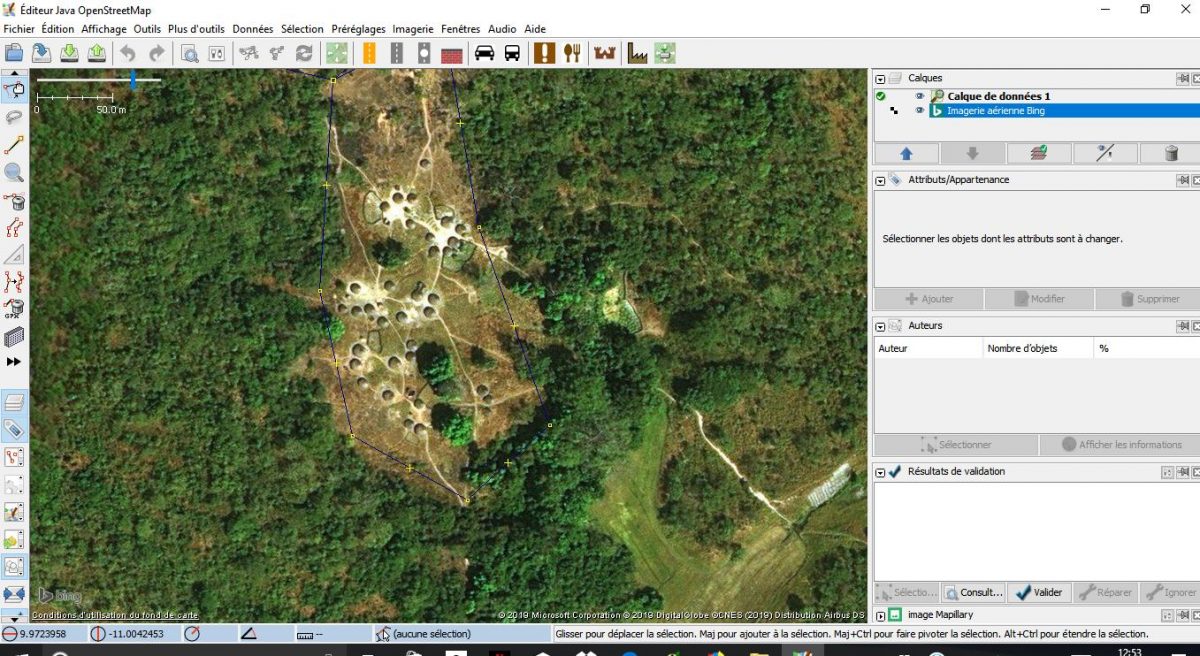
Ongoing research
- Database of land use in 2015 with changes over past 10 years (since 2005).
- A morpho-pedological map of the region and climate statistics.
OSFACO / IRD
About the
organisation
organisation
The organisation focuses its activities on scientific research and the provision of services.
A project
in collaboration
in collaboration
-
Institut de Recherche Agronomique de Guinée (Guinea Institute of Agronomical Research)
Research and Innovation
-
GEO Decisions
Research and Innovation